
There are 11 free 24 Hour Ferries at various places along the Murray River in South Australia, this is the second one (from the river end) at Wellington. This is the river crossing used during the gold rush days to ferry gold travelling from the Victorian Gold Fields to the banks in Adelaide.

This was the ferry we used to cross the Murray, at Tailem Bend. You can notice already that the banks of the river are becoming high. There is quite a climb away from the ferry exit, the further we travel the higher the climb away from the river.

We stopped at Murray Bridge for lunch and I caught this couple having a sunny fishing afternoon. There are no ferries at Murray Bridge as they have a very large bridge, the first bridge constructed over the Murray River in South Australia.

We were stopped at a free camp at Haythorpe Reserve and only had to walk onto a ferry to cross over to the town of Mannum. This is the Main Street at Mannum and the river course is behind the shops on the left divided by an extensive parkland.

The white marker beside the dead tree is a flood marker, the highest flood was 1956.
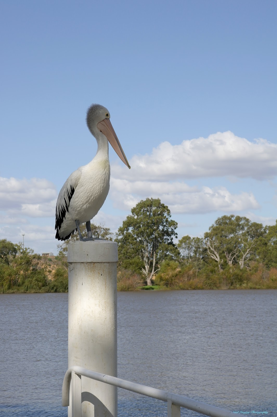
I don't know whether this Pelican is standing guard or looking for lunch but it did not move from this perch in two hours.

The Mannum Reach (straight stretch) of the Murray River is the longest in South Australia.

The extensive parklands at Mannum are accessible from the Main Street (above/right) via small lane ways between shops.

The outlook from another free camp at Caurnamont. Here we met Debbie and Hugh from Maryborough and Ann and David from Hervey Bay.

Another free camp, this time Walker Flat, this time we were treated to a parade of paddle boats and house boats. This is the River Princess, a rear paddle wheel vessel similar to the Mississippi Paddle Boats.

The rear view of the River Princess, far better contrast with the camera focussing away from the sun.

It was only a short walk from our camp site to the location of the Walker Flat Ferry, here I managed to be lucky enough to catch a little sunlight on the sandstone cliffs bordering the Murray River.

The second paddle boat to appear was the Paddle Steamer Marion. Both paddle steamers were heading back to berth at Mannum.

Happy Hour at Walker Flat. This is the second time we have camped with Kaye and Rob along the Murray River. Rob is also a volunteer crew member on the paddle steamers in South Australia, he has been on the PS Marion as a crew member.

At various places along the road following the Murray River there are turn-outs at great view points, this is Forsters Look Out. Notice the amount of water behind the actual river course, it is like this all the way along the river, all the low areas are inundated.
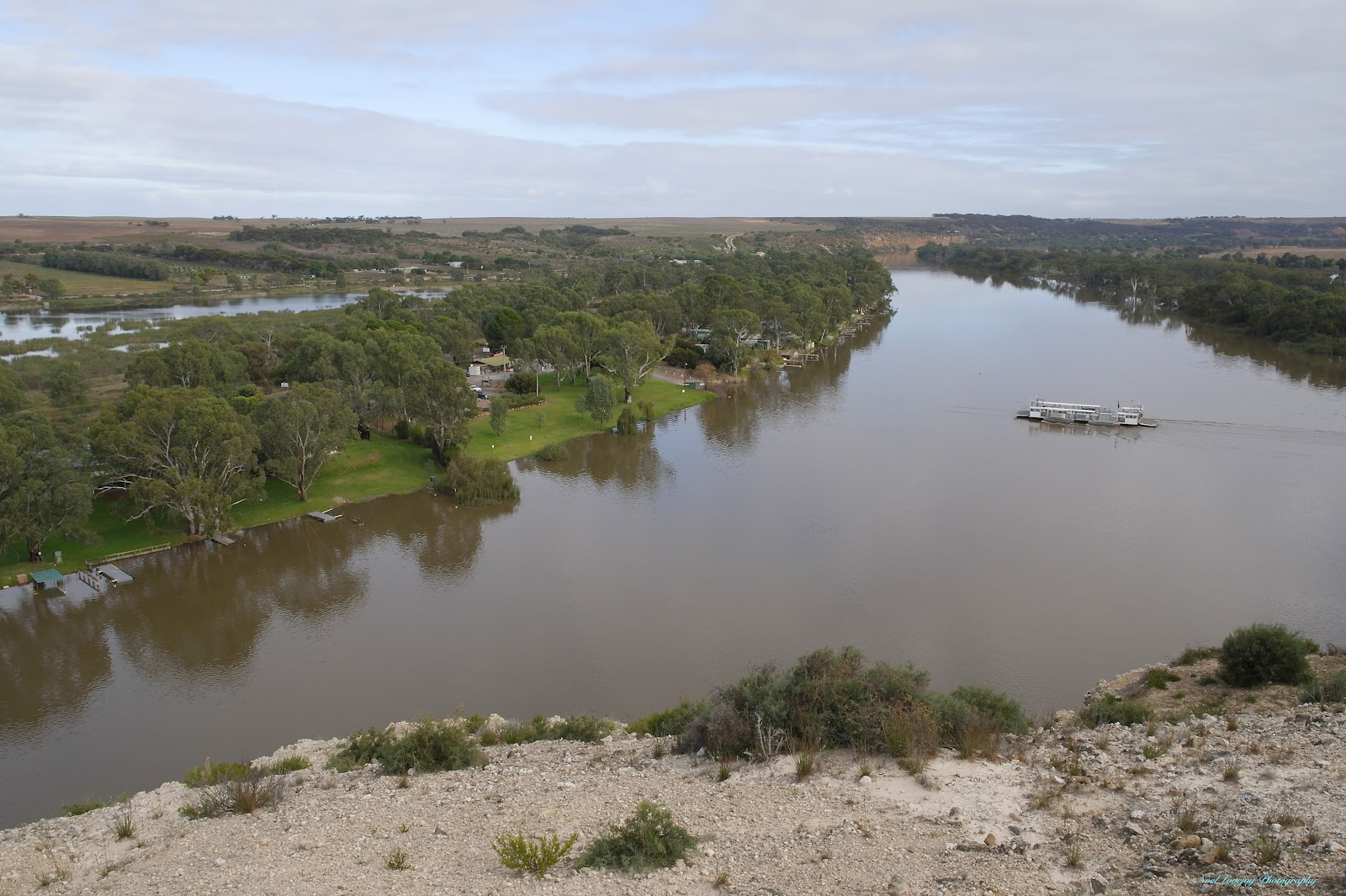
The ferry you can see on the river is the Walker Flat Ferry. We had just crossed over on that ferry and have driven up a steep gradient to this look out point which is the same cliffs in the photograph a couple back with the sun shining on them. The free camp was on the left side about 1km further along from the ferry crossing.

This area of the river is noted for it's high cliffs, this is Big Bend, you cannot tell from the photograph but the bend actually turns through a full 180 degrees. Just two of the many house boats cruising the river. Where the house boats are moored there are BBQ facilities and the house boat occupants had stopped for lunch (and maybe the day).

Another Look Out point, this is at Swan Reach. We had thought about camping over there but it was only a very small area and too crowded for us.

Loch 1 at Blanchetown. This photograph taken from the Sturt Highway Bridge.

We are crossing the river on the ferry at Cadell, our current camping point. Once again you can see that the water is way beyond the tree line on the river bank. The current here is very strong as well. We are now above Loch 1. We have also left behind the hard water from the limestone area of South Australia. Our cups of tea now taste half reasonable.

River side cottages at Morgan. The Murray River travels roughy southward from Morgan to Wellington, before this point the river has been travelling in a generally westward direction.

The Murray River farewells Morgan around another bend and heads southward towards Wellington and Lake Alexandrina.
No comments:
Post a Comment